Synchronising Camera and GNSS Time in Drone Mapping
Understand trigger commands, exposure events, time references, antenna geometry, file sequences, and the evidence needed to match drone images with GNSS positions.
Time connects different records
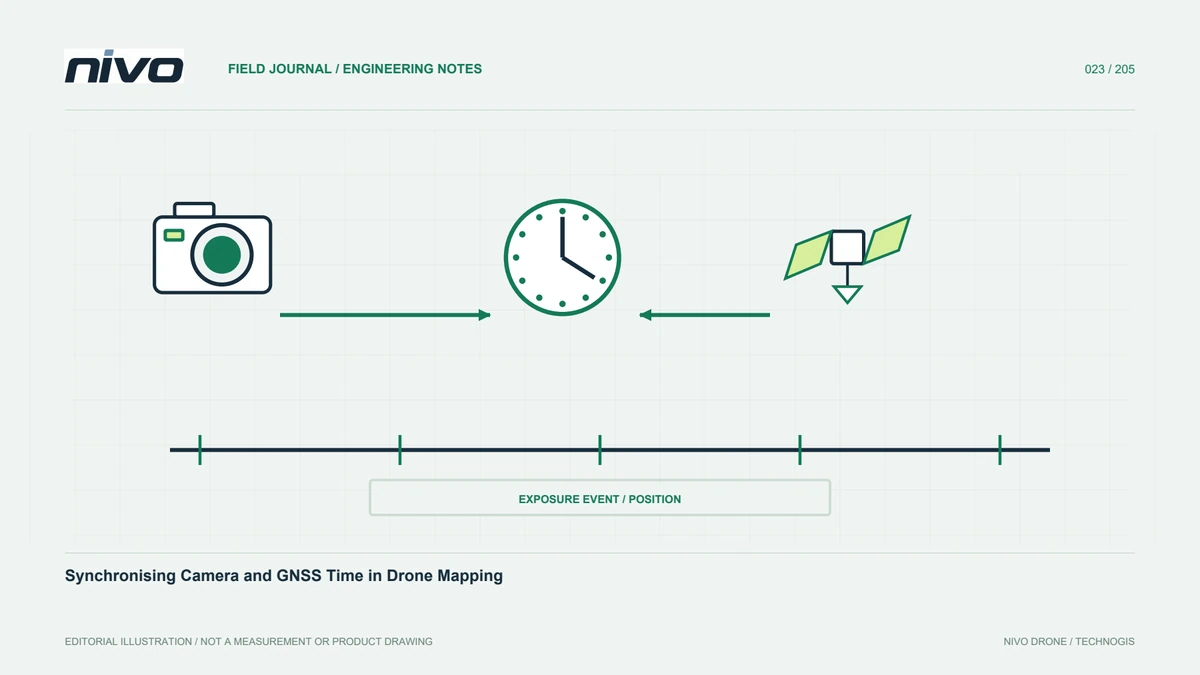
Images and positions may come from devices with different recording methods. Understand when each event occurs and how it is timestamped. Filename time, camera metadata, and flight logs are not automatically equivalent. Integration must define their relationship. Otherwise, apparently good positions may be matched with wrong images. Synchronisation aims at traceability, not merely matching displayed clocks. Check the records actually used in processing and the installed sensor configuration. This gives the processor a defensible basis for matching rather than an assumption that several devices happened to share time correctly.
Distinguish command from exposure
A system may record a trigger request while the camera performs capture according to its state and design. Where feedback exists, explain what it represents. ArduPilot documents triggering and feedback for supported arrangements, but a general capability does not prove it is installed on every aircraft. Ask which relationship is active. Do not substitute command time for exposure without an explained method. The processor needs the actual event definition, especially when an apparently complete sequence contains timing information derived from different parts of the system.
Record the time reference
Devices can use different formats, zones, or time scales. Define source, format, units, and any conversion before combining sequences. Do not shift timestamps until the results merely look aligned. Adjustments need an evidential basis. State missing information and the planned check. Clear documentation allows repetition on another computer or application. It also supports investigation when differences occur later in the sequence even though the initial image matched. A common-looking clock value is not enough to establish the temporal relationship required by the processing workflow.
Keep image order traceable
Review event records with actual files. One missing image can disrupt a matching method that relies on order. An initial matching count does not prove the whole sequence. Check beginning, middle, end, and anomalous sections. Preserve original names and document renamed working copies. Separate multiple flights with clear identities. This permits focused review without manually shifting an entire list and losing its relationship with the original records. It also helps a second analyst identify exactly which acquisition event is associated with a questionable processed position.
Review changed camera settings
Camera configuration, storage, and triggering interface belong in integration review. Changed equipment or settings may require renewed timing checks. Good image appearance does not establish unchanged temporal behaviour. Save sensor identity, relevant versions, and accepted settings. Replacement with another unit follows the required verification process. This article gives no universal delay value or electrical instructions. Methods must suit the actual devices and be demonstrated by competent integrators. Keeping the change record avoids treating a previously accepted timing relationship as proof for an arrangement that is no longer identical.
Connect time with sensor geometry
GNSS position refers to an antenna point that may differ from the camera centre. Correct timing does not remove the need to understand this geometry, nor does correct geometry repair wrong timing. Record the applied correction, axes, and source. Review mount changes and acceptance evidence. Treat temporal and spatial relationships as distinct but connected factors. This helps investigation avoid collapsing several possible issues into a vague statement about image coordinates. It also clarifies which evidence is needed from the integrator and which belongs to processing verification.
Test complete example data
Before large-scale work, use an approved acceptance process to produce representative images, events, positions, and metadata. Run the actual processing workflow and record findings. Importing coordinates into photographs is not the entire test: the relationship must be explainable and the output must meet assessment requirements. Use evidence to locate inconsistencies. Correct the source rather than adding an unsupported manual adjustment. The example should represent the configuration intended for production, not a simplified demonstration missing the devices or recording stages the user will actually depend on.
Preserve the processing method
Record software version, import choices, and matching steps. Retain earlier records when the workflow changes. Do not decide from one displaced image without examining the sequence and observation quality. Control and checkpoints support final evaluation under the project design. Explain what was recorded, how it was matched, and what was checked. Another processor should be able to reproduce the result without guessing hidden offsets. This makes timing a documented part of the georeferencing chain rather than an unexplained correction embedded in one operator's working files.
Provide an operational delivery list
Agree the required originals, event records, GNSS inputs, time definitions, and configuration evidence among operator, integrator, and processor. Check completeness while the field team can discuss findings. Explain missing information and processing consequences before promising accuracy. Use a consistent package for repeat work. Synchronisation has value when documentation supports a real result: the correct event, a suitable position, a known sensor, and geospatial evidence assessed against user needs. That package remains useful beyond the first processing session and supports later review or reprocessing.
Illustrative case: checking an image sequence with a missing record
Consider a hypothetical processing handoff in which the image list and camera-event record do not match as expected. A staff member proposes pairing subsequent photographs by position in the list and continuing. The processor instead preserves the original filenames and investigates whether the discrepancy represents an absent image, a different event definition, or an unresolved time relationship. Samples from the wider sequence are reviewed rather than judging correctness from the first successful match. The integrator explains whether the recorded timestamp refers to a trigger command or a supported exposure-feedback event in the actual configuration. The antenna-to-sensor relationship is checked separately, so a spatial correction is not mistaken for a timing solution. Any conversion or matching rule is documented with its evidential basis. This example is explicitly hypothetical and provides no universal delay or wiring instruction. Its outcome is a traceable association between each usable sensor record and the relevant positioning information. If the available evidence cannot establish that relationship, the limitation remains visible. The delivered workflow can then be repeated by another analyst without silently shifting the sequence or inheriting a hidden manual correction that only the first processor understands.
Where the relationship can be established, the processor may continue with a documented matching rule. Where it cannot, the project may need to exclude unresolved records or obtain additional evidence under an agreed plan. That distinction is decided against the deliverable requirements rather than hidden inside manual editing. The handoff retains the original sequence, the event definition, the time conversion if any, and the treatment of incomplete records. Acceptance checks representative portions of the complete usable sequence. This makes the result defensible and helps future reprocessing avoid reintroducing an ambiguity that the original reviewer had already identified.