GNSS Base Antenna Height and the Antenna Reference Point
Keep station marks, measured antenna heights, reference-point definitions, antenna models, and calibration information traceable throughout GNSS processing.
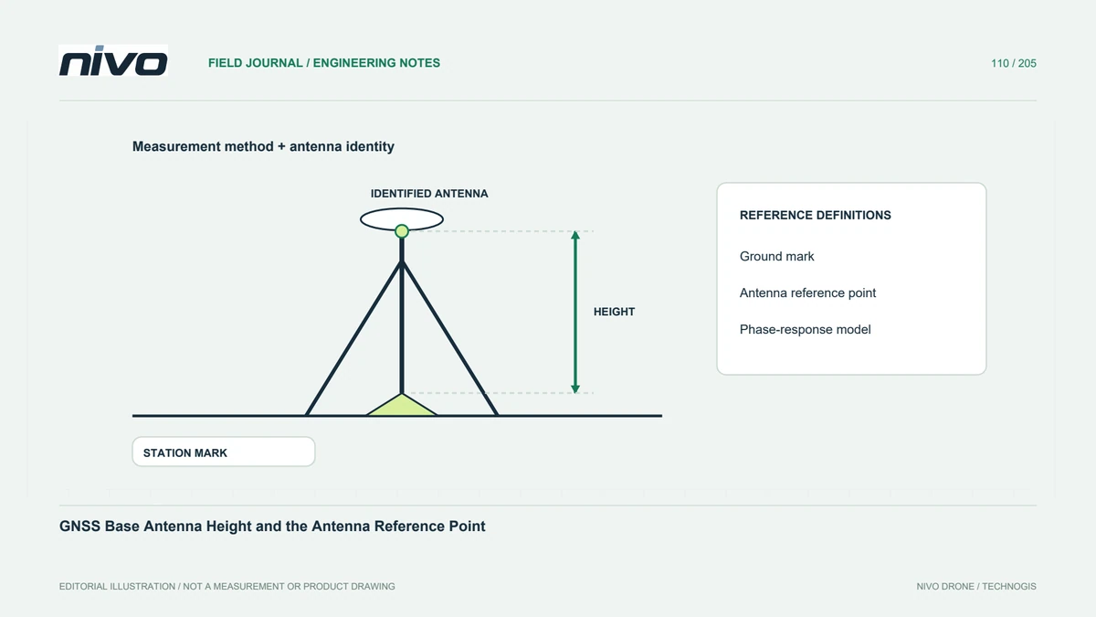
Distinguish the mark from the antenna
A station mark, an antenna reference point, and the antenna's electrical response are related but different concepts. Identify which coordinates and heights the workflow uses. Do not enter a physical tape measurement into an unexplained field merely because it accepts meters. A clear diagram of the station setup establishes the relationship that field staff and processors must share before corrections or post-processing results are treated as dependable.
Record the exact measurement definition
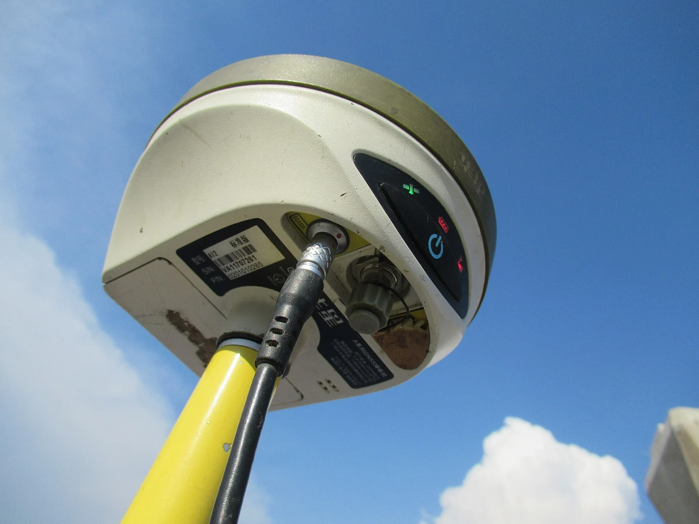
A height record should identify its endpoints, measurement method, units, and the applicable antenna or instrument guidance. Distinguish vertical measurements from slant measurements and any documented conversion. Retain repeated checks where the project procedure requires them. A single number without its definition cannot reliably describe the installation. Photographs should show the station mark, mount, and measurement reference clearly enough that another surveyor can understand the recorded geometry.
Identify antenna and radome correctly
Antenna calibration information is tied to defined antenna types and, where relevant, radome codes. Similar housing appearance is not sufficient identification. Preserve model, serial information, orientation where required, and the calibration reference actually used by the processing workflow. Do not select a familiar model merely to populate a software field. An incorrect description can obscure the relationship between the physical setup, reference definitions, and modeled antenna behavior.
Keep coordinate and calibration references consistent
Station coordinates, orbit or reference products, and antenna calibration information need compatible definitions in the chosen method. Read the relevant processing and service guidance rather than combining files solely because they are downloadable. Record versions and sources. A precise-looking output does not prove the reference chain is coherent. The technical review should explain the actual convention and identify uncertainties that could affect the final georeferencing result.
Manage changes during the session
If the mount, antenna, or measured height changes, preserve the time and new setup identity. Do not silently merge observations from different physical arrangements under one unchanged station description. Connect each period with its field record and processing treatment. A moved tripod can create a different question from a corrected transcription error. Distinguishing them protects the evidential chain and helps determine whether additional observations or a revised processing strategy are needed.
Hand over the station geometry with the data
Provide the station sketch, height definition, measurements, antenna identity, coordinate source, and relevant calibration references. Link them to the observation periods and accepted processing version. A colleague should reconstruct the geometry without asking which point the tape touched. This supports practical NiVO georeferencing and makes review of a vertical discrepancy more focused, while keeping documented antenna setup separate from an unsupported guarantee of overall map accuracy.