GNSS Datums and Elevation: Avoiding Reference Errors in Drone Maps
Understand coordinate references, datums, ellipsoidal and orthometric heights, geoid models, transformations, and metadata for consistent drone-survey deliverables.
Coordinates need a reference definition
Position numbers are incomplete without their reference. Coordinate system, datum, units, and other relevant definitions determine meaning. A drone product can appear tidy in one application yet disagree with another dataset if those definitions differ. Agree references before measurement, not after selecting whichever label makes the display look right. Field staff, processor, and user need the same definition. It becomes the basis for control, GNSS observations, processing, and delivery. This prevents a visually convincing map from concealing an unresolved reference assumption.
Distinguish datum and projection
The datum or reference frame concerns coordinates relative to Earth; a projection is part of representing coordinates on a plane. Changing a label does not necessarily perform the required transformation. Conversely, transforming an incorrectly understood source can introduce error. Consult providers and software documentation, and clarify missing information first. A generic description such as GPS coordinates is too broad. Another person must be able to use the definition without guessing. Clear references are essential when several suppliers contribute control or background datasets to one project.
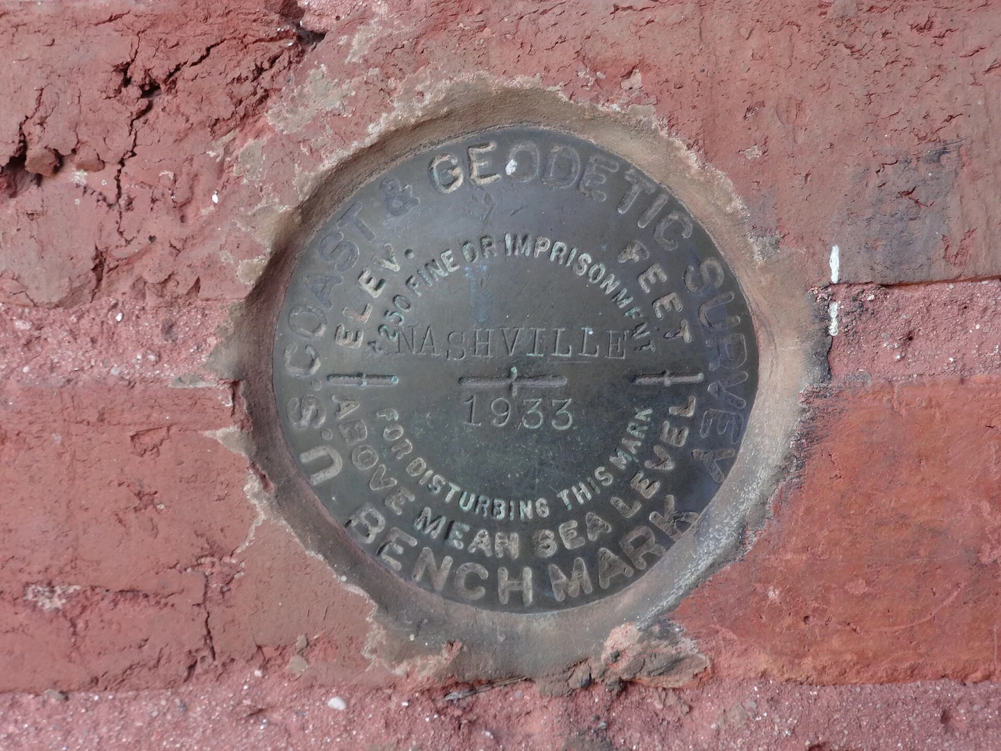
GNSS height may differ from project elevation
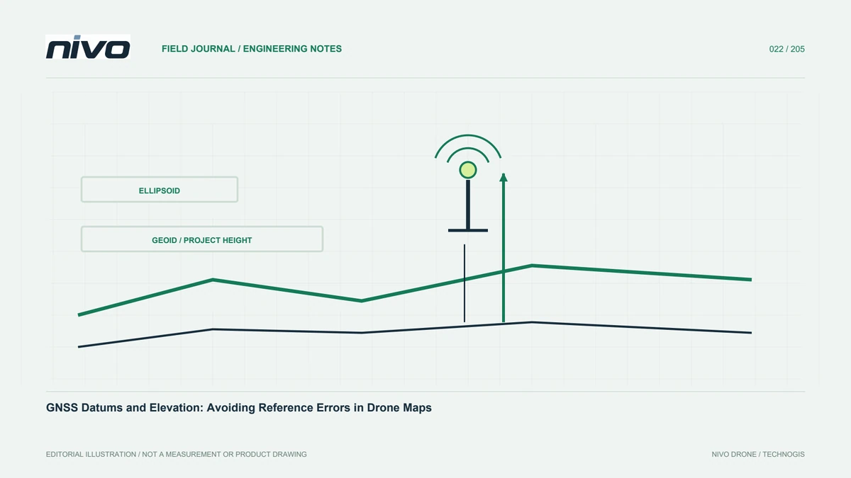
GNSS measurement commonly relates to a geometric reference that differs from height systems used in engineering. Ellipsoidal and orthometric height are not interchangeable merely because both use metres. A geoid model may connect definitions where appropriate. NOAA explains the concepts, but the model for a particular country or project must come from the relevant source. Do not choose another region's model simply because software lists it. Understanding the relationship is necessary before interpreting a vertical difference as an aircraft or sensor error.
Identify model and coverage
Record the name, version, coverage, and origin of geoid or transformation resources. Confirm suitability for the datum and task. Similar filenames do not imply equivalent results. Check resource availability when repeating the process elsewhere. Document what was actually applied and state unknowns or coverage limits. This lets users investigate elevation differences from evidence rather than adding a constant to make surfaces align. It also preserves enough detail for another processor to reproduce the operation without silently substituting a different resource or method.
Keep control references consistent
Control points, checkpoints, camera positions, and outputs need understood reference relationships. Mixing sources may create differences wrongly blamed on a sensor. Obtain measurement metadata, including coordinate and height definitions. Review compatibility before processing and preserve originals with transformation history. Independent checks also require consistent references. Comparing values on different definitions does not establish product accuracy. The project record should explain the relationship rather than assuming all survey files share one reference merely because they cover the same physical site.
Check axes and units
Simple interpretation mistakes can involve latitude and longitude order, units, or column mapping. Inspect representative values against known locations and read format documentation. Confirm software interpretation during transformations. A file opening successfully is not proof it was understood correctly. Keep a checked import example and column map. This supports repeatability and reveals changes in a provider format or application version. It is a small preparation task with substantial value because later processing may otherwise create polished outputs from incorrectly interpreted source coordinates.
Separate labelling from transformation
Assigning a reference describes existing coordinate meaning; transformation changes the representation through a suitable operation. These actions are not interchangeable. A wrong source label can corrupt later operations. Establish the original definition from evidence. PROJ documents geodetic transformations, but selecting an operation requires source and destination context. A result resembling a background map is not sufficient justification. Explain the before-and-after references and any supporting files. This makes the operation defensible instead of relying on undocumented adjustments made until a display appears acceptable.
Investigate differences in components
Separate horizontal and vertical discrepancies under the agreed assessment method. A uniform-looking offset may provide a clue but does not prove a cause. Review control, reference definitions, transformation, and model production. Preserve initial results before adjustment. Use qualified surveying or geodetic support where required. A report should distinguish observations, checks, and explanatory limits. This helps users determine whether further work concerns measurement, processing, or interpretation when moving data into another project environment, without disguising uncertainty through an apparently precise correction.
Deliver usable metadata
Provide horizontal and vertical definitions, units, control sources, transformations, and relevant resource versions. Use information another processor can apply, not only internal abbreviations. State untransformed data and limitations. Preserve references between repeat surveys so comparison does not begin with rediscovering definitions. A useful drone product is more than an attractive image or surface. Users need to know how position and elevation were established and how to combine the result consistently with other data. That understanding supports traceable geospatial decisions after the original team has left the project.
Illustrative case: investigating an elevation mismatch before adjustment
Imagine a hypothetical project where a drone-derived surface does not agree vertically with a supplied control dataset. The first suggestion is to shift the surface by a constant amount so the display looks aligned. The processor instead preserves the original results and requests the horizontal and vertical reference definitions for both sources. The survey lead checks whether the supplied heights, GNSS observations, and intended deliverable use compatible definitions. Any proposed geoid model or transformation resource is identified by source, version, and coverage rather than selected merely because it appears in a software menu. The reviewer also checks units, axis interpretation, and the actual processing steps. The visible difference is treated as an observation, not proof of a specific cause. This hypothetical scenario supplies no project coordinates or correction value. Its acceptance evidence explains what reference each dataset represents, which operation is justified, and how the resulting comparison is checked independently. If the source metadata remains incomplete, the limitation is stated rather than hidden behind a neat image. The final package allows another processor to repeat the reasoning without guessing which undocumented adjustment made the map appear to fit.
A justified transformation between known references is different from an unsupported visual adjustment. The former can be documented and repeated; the latter may conceal the very discrepancy the project needs to understand. The team chooses the evidence-supported operation where possible, or qualifies the vertical comparison when definitions remain unresolved. Handoff notes preserve the original files, interpreted references, resource versions, processing steps, and assessment outcome. Another user can then determine whether the surface is suitable for the intended decision. The example emphasises that a convincing alignment is not acceptance evidence unless its underlying reference relationship can also be explained.