u-blox GNSS and Satellite Reception Quality in Drone Surveys
Connect receiver identity with antennas, sky visibility, multipath, installation, configuration, raw observations, and independent verification of geospatial results.
A receiver is part of a larger system
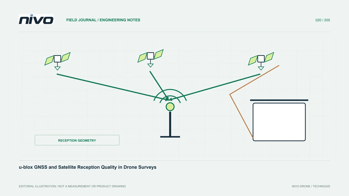
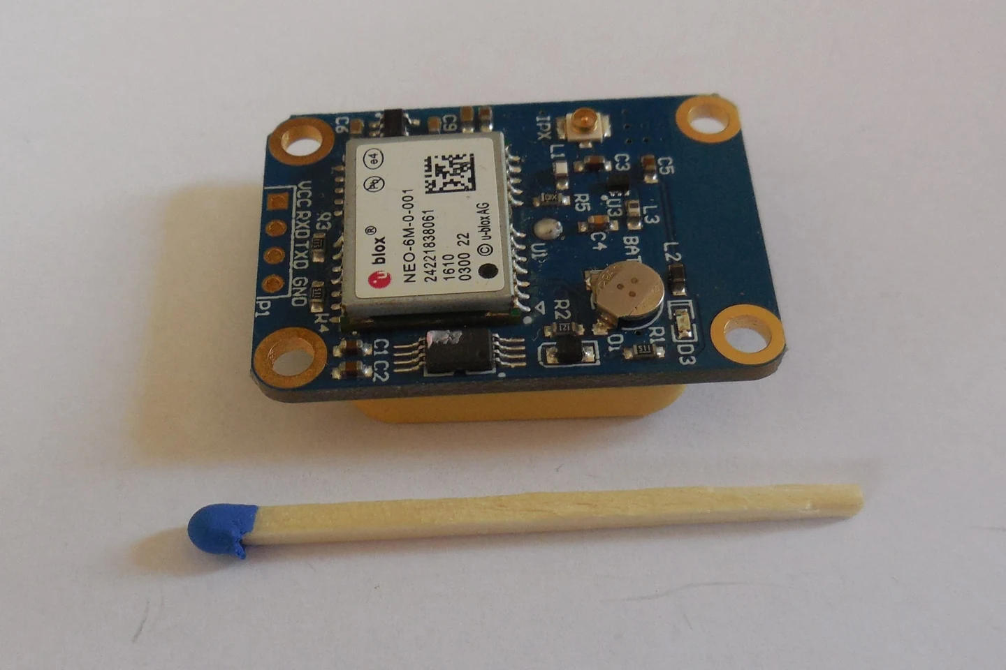
A GNSS receiver name identifies technology, but positioning depends on antenna, environment, installation, configuration, and processing. u-blox products have different characteristics; one claim should not describe the entire family. Ask which model is installed and which functions are used. Link these with project needs, such as raw logging or corrections. This makes suitability assessable and identifies outstanding integration work. Brand identity is useful context, but the configuration and evidence determine what the team can reliably deliver using the supplied aircraft.
Evaluate sky visibility
Objects can obstruct directions and affect the information available to the receiver. Antenna placement must follow manufacturer and integrator guidance. Ground measurement sites also need review. Outdoors does not automatically mean suitable: vegetation, walls, vehicles, and structures may matter. Link environmental notes with time and measurement identity. This helps explain differences between sessions. A useful record is more precise than a general recollection that the site was open. It gives the processor and technical team evidence about the environment in which observations were obtained.
Understand multipath in context
Multipath involves signals arriving by different routes, including reflections, which can affect positioning observations. u-blox explains mechanisms and mitigation in its technical material. Mitigation features do not make the environment irrelevant. Detected signals do not all provide equivalent information. If results differ near structures, record conditions and method, then assess evidence before assigning a cause. The presence of a building alone is not a complete diagnosis. Keep device capability, observed conditions, and the quality of final results as related but distinct questions.
Distinguish constellations and frequency bands
Support for multiple satellite systems differs from support for multiple signal bands. Read both from the actual receiver and antenna specifications rather than using the terms interchangeably. Capabilities must fit processing and correction needs. If active functions are unclear, ask the integrator about the installed state. Precise terms support useful acceptance testing and prevent unsupported accuracy promises. The final product still needs verification against project requirements; a longer signal list is not an alternative to demonstrating that the workflow produced acceptable results.
Review the installation environment
Electronic equipment, wiring, and antenna arrangement need combined integration assessment. Do not move or add devices without reviewing consequences. A new payload arrangement should be linked with checks and change records. Older tests may not represent it. This article does not prescribe universal separation or wiring techniques. Its purpose is recognising reception quality as a system issue requiring people familiar with the aircraft and devices. Documentation makes the accepted arrangement reproducible and helps identify which changes might be relevant when a later mission produces different observations.
Read status with its limitations
Satellite counts, solution type, and other indicators support monitoring, but each has a source and limits. Consult model documentation. One status at one time does not describe an entire observation sequence. Preserve records needed to examine the relevant period. Processors should know where conditions changed. Timing and configuration provide more useful context than a report that many satellites were visible. This also helps distinguish a temporary observation issue from a mistaken interpretation of the interface, without assigning certainty beyond the available evidence.
Preserve processing inputs
If post-processing is planned, confirm observations, format, time coverage, device identity, and links to cameras or other sensors. A simple coordinate file may not replace raw observations required by the software. Demonstrate an end-to-end example before major acquisition. Document limitations early so the method can be adjusted appropriately. Missing information cannot always be reconstructed from an existing map. A clear delivery checklist helps the field team capture the needed evidence while it is still possible rather than receiving an impossible request after demobilisation.
Assess products using independent observations
Use evaluation suited to the project. Receiver indicators form part of the evidence but cannot assess the complete map. Review checkpoints, coordinate systems, datums, and heights. Apparent disagreement may arise from reference or transformation differences rather than the receiver. Separate conditions, processing, and verification in the report. This helps users interpret limits and choose follow-up. It also protects against an attractive display being treated as proof of accuracy while the actual deliverable has not been compared on a consistent reference basis.
Make integration decisions from evidence
Request model, antenna, version, active functions, and representative data. Connect these with installation and acceptance records rather than a receiver table alone. Review replacements and added equipment through configuration control. Field experience can then improve site selection, checks, and documentation. Keep the discussion focused on traceable geospatial results. Technology names provide context; readiness follows from the integrated arrangement, reception conditions, processing, and agreed quality evidence. This gives users a defensible explanation of both demonstrated capabilities and tasks that still require further assessment.
Illustrative case: reviewing reception conditions beside a structure
Consider a hypothetical survey team comparing observations made in an open area with observations near a large structure. A participant proposes treating the receiver brand as sufficient evidence that both sets have the same quality. The survey lead instead records the actual receiver and antenna model, site context, and timing of the observations. The technical reviewer examines the installation and relevant indicators without declaring a cause from the presence of the structure alone. The processor checks whether both datasets use the same reference and method before comparing their results. A multipath explanation remains a hypothesis unless supported by the appropriate evidence; it is not used to excuse every discrepancy. Where further observations or independent checks are needed, the team states that requirement rather than editing the output until it resembles a background map. This is an illustrative scenario, not a claim about a particular u-blox product's performance. Its outcome separates device capabilities, reception conditions, processing choices, and assessed results. The resulting report tells the user which evidence supports the comparison and which uncertainty remains. That distinction allows a meaningful next step without confusing a technology feature with an automatic guarantee for every measurement environment.
The next decision may be to obtain better-defined independent evidence, or to limit the claim made from the existing observations. Neither requires dismissing the receiver's documented features; it simply keeps those features separate from unverified site results. The handoff identifies the compared conditions, reference definitions, recorded indicators, and quality checks actually used. If an additional assessment is proposed, its purpose is stated before collection. Acceptance rests on the demonstrated result and its boundaries. That makes the report useful to a later user who needs to judge suitability, rather than merely recognise a well-known technology brand.