From Drone Photographs to an Orthomosaic: Workflow and Quality Checks
Follow source-image inspection, reconstruction, referencing, orthorectification, seam checks, and export so an aerial mosaic is ready for responsible GIS use.
An orthomosaic is more than a panorama
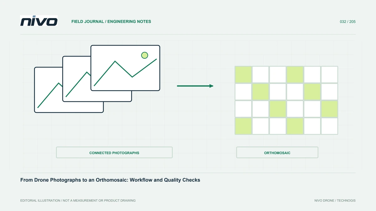
An orthomosaic combines geometrically corrected imagery within a coordinate framework. Unlike an ordinary panorama, it is intended to function as a map. Camera geometry, exposure positions, surface shape, and field references all influence its usefulness. A visually attractive mosaic can still contain displaced features or incorrect joins. Define whether users need interpretation, digitising, particular measurements, or background presentation. These purposes determine the checks required. Specify visual resolution and positional accuracy separately, since a sharp texture does not automatically establish that all visible objects are correctly located throughout the surveyed area.
Inspect source images before full processing
Inventory image counts, timestamps, positions, and flight blocks. Look for blur, extreme exposure, blank frames, and trigger gaps. A questionable image should not be discarded automatically because removing it can weaken connectivity; assess its role and record exclusions. Check image dimensions, lenses, and relevant settings. Mark configuration changes so processors can group cameras appropriately. Early inspection prevents a long run from merely reproducing capture problems that were already visible in the source files. Keep field records alongside the inventory so unexplained gaps can be compared with known interruptions or operational changes.
Review image connections and camera orientation
Photogrammetric processing matches features across images to estimate camera orientation and initial scene geometry. Textured surfaces tend to offer more usable relationships than water, uniform areas, and strongly repetitive patterns. Check unaligned cameras and disconnected groups instead of judging success by processed-image count alone. Review edges, flight joins, and large elevation changes. When geometry is weak, investigate the photographs and route plan before repeatedly changing parameters without a hypothesis. Stronger downstream settings cannot reliably compensate for missing observations, so the initial connection stage deserves attention before generating expensive dense products.
Introduce references through a controlled method
Camera positions, ground control, and GNSS information can place the model within the project framework. Their quality and use should match the actual measurement conditions. Mark the same geometric target centre consistently in every relevant image. Check axes, units, height systems, and datum definitions before optimisation. Reserve independent checkpoints rather than using every reference to constrain the solution. If a shift appears, investigate source coordinates, image marking, and transformations. Strongly constraining a model to incorrect inputs may improve internal agreement while leaving the delivered product wrong in ways that internal statistics conceal.
Use a suitable surface representation
Orthorectification needs surface shape to account for relief and viewing geometry. Buildings, slopes, and vegetation can show visual displacement if that representation is inadequate. A coarse surface may distort object edges or roof positions. Tall structures can hide surfaces even when their roofs are well observed. Determine whether the project requires a specialised approach for built-up areas. Sharpening colour will not fix geometric errors. Compare difficult locations with source images and elevation data to distinguish reconstruction problems from later mosaicing issues. That diagnosis helps direct improvements towards the stage that actually caused the defect.
Check seams and changing objects
Vehicles, machinery, people, shadows, and moving foliage change between exposures. A mosaic can therefore contain doubled objects, missing portions, and inconsistent textures. Review active areas, roads, and scenes captured under changing illumination. If seam editing is available, preserve its history and ensure a cosmetic improvement does not create a misleading interpretation. Progress documentation should identify acquisition time because a single mosaic need not represent the entire site at one instant. Field activity notes help explain these artefacts and indicate where a closer photograph or another observation is needed for a particular question.
Export defensible raster settings
Choose output pixels based on source information and user needs; a finer export does not generate new detail. Check CRS, extent, NoData, bands, compression, and recipient compatibility. Tiles and overviews can make large products easier to use without replacing the main analytical version. Label lighter communication copies separately. Open exported samples in another application and inspect edges and important locations. Record settings so recipients understand what they are receiving. A successful export is not merely a file created without errors, but a product that retains the intended meaning, reference, and usable information after leaving the processing project.
Assess readability and position independently
Visual review covers sharpness, colour, gaps, seams, and ambiguous objects. Geometric assessment compares suitable independent checkpoints or other agreed references. Record findings spatially so corrections can target affected areas. A small raster pixel is not a substitute for a positional test. Where requirements are not met, improve observations or identify the limitation explicitly. Users can then judge whether the mosaic supports digitising, site overview, or more demanding tasks requiring additional survey evidence. Reporting these distinctions prevents an attractive preview from being interpreted as validation of every possible measurement that a GIS tool allows.
Prepare a handover package that explains the result
A useful package contains the main raster, valid-coverage boundary, checkpoint map, quality report, and processing notes. Include a tile index and flight identities for multi-block work. Explain limitations around water, strong shadows, and moving objects. Provide an example of opening the raster in GIS and test portable file links. NiVO aircraft and RGB payload selection support acquisition, while final orthomosaic quality is demonstrated by the complete checking workflow. A traceable product is more useful than a large image whose reference, source history, and limitations are known only to its processor.
Illustrative scenario: a broken vehicle at a mosaic seam
Imagine a hypothetical warehouse survey where a delivery truck moves between overlapping photographs. The orthomosaic shows a shortened vehicle beside a convincing road surface. A manager asks whether the broken shape indicates an obstruction or damage. The processor checks source photographs and identifies the same truck at different positions and times. The finding is recorded as a mosaicing effect involving a moving object, not a measured facility defect. Reviewers inspect nearby stable markings and elevation geometry separately, because explaining the truck does not establish that every surrounding feature is correctly located. The original result remains available for comparison.
If seam editing is appropriate for the agreed product, the team documents the change without inventing a vehicle position unsupported by observations. A close photograph or separate site check is requested if the truck's actual condition matters. Metadata states the capture interval and limitations associated with moving activity. Reviewers can therefore distinguish a visual composition from a simultaneous photograph of the whole site. The team also keeps the map useful for the stable objects it was intended to document, instead of rejecting the entire dataset or accepting the strange vehicle shape as real simply because it appears within a georeferenced product.
Acceptance criteria distinguish cosmetic remediation from additional evidence about an operational event. A seam edit may improve legibility for mapping stable features, but it cannot establish the truck condition the manager asked about. The annotated review therefore links that question to a separate verification request. The team retains source timestamps and edit history with the delivered version. Another analyst can understand why the visual issue was addressed, which question remains unanswered, and why the orthomosaic should not be used to reconstruct the movement sequence by itself.