Classifying Point Clouds into Ground, Vegetation, and Objects with Checks
Build traceable point-cloud classification through explicit class definitions, representative tests, profile review, retained attributes, and assessment of derived products.
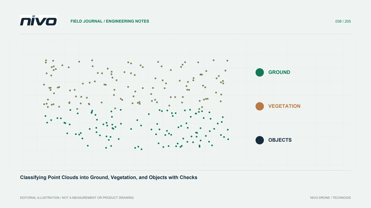
Define what each class means
Classification labels points so selected surfaces can support analysis or products. Define required classes before running an algorithm. Ground, buildings, vegetation, water, and noise can be obvious in some places and ambiguous in others. Terraces, active fill, and low vegetation may need project-specific rules. Use a scheme compatible with the recipient's format and document extensions. Application colours are not a class definition. Consistent meanings allow blocks to be compared and terrain products to be created by different teams without silently changing what a label represents.
Inspect source characteristics first
Photogrammetric and LiDAR clouds can differ in attributes and observational support. Review source, references, density, point distribution, and geometric quality before classification. Look for double surfaces, outliers, and poorly supported areas. Labelling cannot correct an underlying orientation or alignment problem. Preserve an unchanged source version and record existing classes before replacing them. The task may be initial classification, refinement, or independent review of another supplier's work. A clear inventory avoids discarding useful earlier information and ensures reviewers know which operations have already influenced the dataset they are assessing.
Test representative difficult conditions
Include flat ground, slopes, structures, low vegetation, and sharp landforms where present. A setting that succeeds on an easy sample may fail elsewhere. Establish consistent review areas and profiles for comparing parameter choices. Record why samples were selected and the outcome of each test. Very diverse terrain may justify different processing zones while retaining common class definitions. Targeted testing is more efficient than repeatedly classifying everything and later discovering that an improvement in one area erased important form in another. Keep the evidence needed to explain that trade-off.
Review ground extraction as a shape problem
Ground algorithms apply particular height and neighbourhood relationships. Loose settings may include low objects; restrictive settings may remove valid ridges or steep surfaces. Read parameter definitions and avoid changing everything at once. Compare profiles before and after processing with imagery or field context. Where ground observations are sparse, an algorithm cannot create missing measurements. If terrain interpolation follows, distinguish classification quality from limited support: both can create raster defects, but require different responses. A smooth surface is not automatically a better representation of the ground that was actually observed.
Handle noise without losing traceability
Isolated or distant points can disturb derived models, but thin objects and real details may also be sparse. Test noise treatment on samples containing important features. Retain labels or an earlier version before permanent removal. Do not assume every extreme point is an error without context. A small disturbance can create a misleading elevation spike, whereas overfiltering can remove the asset an inventory seeks to identify. Record selection and exclusion criteria so recipients understand how observations entered an analysis and can revisit decisions for a different use.
Inspect class boundaries and tile joins
Review ground-to-building edges, slope toes, channels, and low vegetation relevant to the site. In tiled projects, confirm that separate processing does not create artificial lines or inconsistent labels at joins. Use appropriate surrounding support for the chosen method, then inspect across boundaries after recombination. Preserve a spatial findings map. Terrain contours or rasters may expose seam artefacts that are difficult to notice in a top-down point display. Checking each tile independently is therefore insufficient to demonstrate consistency of the combined dataset users will actually analyse.
Validate for the intended application
Classification for terrain differs from vegetation inventory or visual presentation. Define assessment against the decision users need to make. For terrain, inspect ground support and compatible elevation references. For object categories, use reference areas and explicit class definitions. A single overall score can hide important errors in a small category. Document manual-review method and extent. Explain which classes are reliable, which conditions remain difficult, and whether limitations affect agreed outputs. This connects validation to usefulness rather than presenting a colour-coded cloud as evidence that every label is equally dependable.
Retain attributes and export rules
Deliver necessary attributes, references, and class definitions in a format recipients can interpret. Test labels, flags, and colours in their application. Colour alone should not replace classes when analytical selection is still required. Include counts, rules, and significant processing history. If a lightweight review copy is supplied, identify differences in density or attributes from the main cloud. Test a sample before transferring the full package. These checks preserve the meaning of classification when data leaves the processor's environment and enters another team's software and procedures.
A stepped-site example
A site containing embankments, elevated roads, shrubs, and buildings may expose different failures under one ground setting. Compare representative profiles and document any justified zone-specific treatment. Do not classify every low surface as ground merely to smooth the DTM. If an underlying surface is required but not observed, explain supplementary-data or interpolation needs. NiVO sensor choices provide initial observations; classification determines how those observations are used. A traceable workflow separates measurement, class interpretation, and additional modelling, allowing recipients to understand which parts of the final product are supported directly and which depend on further assumptions.
Illustrative scenario: ground classification at an embankment
Imagine a hypothetical mapping block containing a low building, shrubs, a steep embankment, and an open access road. One automatic ground setting performs well on the road but removes part of the embankment crest and accepts some shrubs nearby. The processor does not select that setting merely because the overall terrain raster looks smooth. Instead, the team defines what the ground class must represent for the requested product, then creates a fixed review set across all four conditions. Source imagery and relevant field records provide context for interpreting the profiles, without being treated as independent elevation proof where they cannot supply it.
Two parameter choices are compared on the same examples. A change that restores the crest but introduces objects elsewhere is not accepted as a universal improvement. The team investigates whether justified processing zones are needed and records the rules connecting those zones to one consistent class definition. Original labels remain available. Noise treatment is evaluated separately so a classification problem is not hidden through indiscriminate point deletion. Any terrain interpolation is documented as another step rather than confused with the evidence for whether a point belongs to ground.
The handover includes class meanings, version identities, counts, review locations, and known difficult conditions. Recipients can distinguish the main classified cloud from a coloured presentation copy. Where an embankment detail is important to the decision, suitable reference evidence is reviewed before that detail is accepted for measurement. The hypothetical lesson is that classification quality depends on the intended meaning and checked consequences, not on colour consistency or smoothness alone. The workflow also makes later revision possible without requiring another analyst to reconstruct why particular labels were changed.