Choosing Spatial Join Predicates Without Double Counting
Define interior, boundary, and overlap behaviour before joining drone-derived assets to zones, then audit unmatched and multiply matched records.
Describe the intended relationship
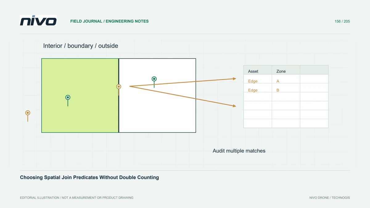
A spatial join assigns information according to a geometric relationship, but ordinary language such as inside can conceal several different rules. A point strictly in a polygon interior differs from one on its boundary. A line crossing a zone differs from a line entirely covered by it. Define the relationship in terms of the project question before selecting a predicate from a software menu.
Test boundary cases explicitly
Predicates such as intersects, contains, and covers do not treat all boundary situations identically. Create a small test containing an interior point, an outside point, and a point exactly on a shared edge. Include a line touching a corner and another crossing the polygon. Check the actual software's results so the chosen rule is understood rather than inferred from a translated interface label.

Check one-to-many behaviour
One asset can match multiple zones when polygons overlap or the predicate includes shared boundaries. A join that expands rows can then double-count assets in a summary. Conversely, choosing the first match can hide ambiguity. Retain stable source identifiers and inspect match counts per asset. Agree on a rule for allocation, exception reporting, or genuine multiple membership instead of silently dropping duplicate-looking records.
Reconcile coordinate and geometry assumptions
Use compatible coordinate references and valid geometries before testing relationships. Inspect precision and any snapping or transformation applied during preparation. A point very near a boundary can change membership after a small geometric edit, which may reflect data uncertainty rather than a software fault. Avoid using an arbitrary buffer simply to force every record into a zone without documenting the altered question.
Audit a small known example
In a hypothetical inspection inventory, join observed roof defects to maintenance areas. Review known interior defects, an edge defect, and an asset whose footprint crosses two areas. Decide whether assignment follows the observation point, the full asset footprint, or a designated ownership record. Compare the joined row count and unique defect count with the original inventory, and investigate every unmatched or multiply matched case.
Deliver a join policy with the results
Deliver the predicate, geometry inputs, coordinate handling, allocation policy, and exception table with the joined dataset. Preserve source and destination identifiers so counts can be traced back. Acceptance should demonstrate expected behaviour on known cases and consistent totals under the agreed policy. A completed spatial join is a geometric result; administrative ownership or operational responsibility may still require a separate authoritative rule.