Repairing Polygon Geometry Without Changing Its Meaning
Diagnose invalid polygons, review the effects of automated repair, and preserve feature identity, area evidence, and intended boundaries throughout GIS cleanup.
Separate geometric validity from correctness
A polygon can be valid under a geometry model while representing the wrong building, land-cover patch, or project boundary. Conversely, an intended boundary can contain a self-intersection that prevents reliable processing. Treat validity as one technical check within a broader interpretation review. A repair tool can help construct usable geometry, but it cannot decide the correct real-world boundary from topology alone.
Locate the exact defect
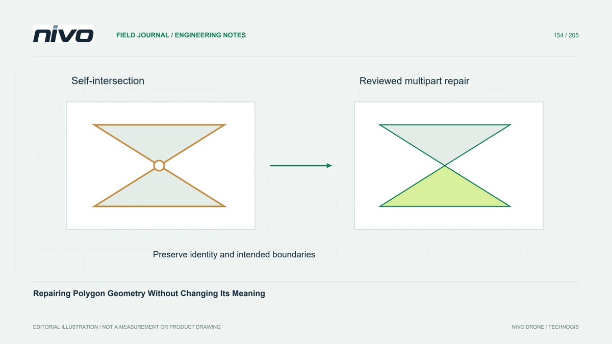
Run a validity check that reports the location and reason for failure, then inspect that area at a suitable scale. Compare it with the source orthomosaic, survey evidence, and neighbouring features. A bow-tie crossing, misplaced hole, or collapsed narrow segment can have different intended resolutions. Avoid applying the same automated correction to an entire layer before understanding representative defect types.
Review repair output types
Repair may split one polygon into several parts or produce a collection containing lower-dimensional remnants. Confirm the output geometry type, feature count, identifiers, and handling of collapsed elements. A downstream format expecting simple polygons may reject or silently omit unexpected components. Decide explicitly whether multipart outputs are acceptable and how any separated parts retain their relationship to the original feature.
Compare meaning before and after
Compare area, perimeter, holes, and boundary position before and after correction using an appropriate measurement method. Investigate large changes and inspect smaller changes near critical boundaries. An area difference alone cannot show whether the intended region was preserved. Keep original geometry and attributes so a plausible-looking repaired outline can still be challenged against the evidence that defined the feature.
Test the downstream operation
In a hypothetical roof inventory, examine a self-crossing outline around a narrow loading canopy. Compare candidate repairs with the actual visible edges and the inventory's feature definition. Check the repaired geometry in the intended spatial join or area calculation, then verify neighbouring features were not altered unintentionally. Refer unresolved interpretation to the project owner rather than accepting whichever output happens to pass validation.
Keep a reversible correction record
Deliver the corrected layer, original identifiers, defect summary, repair method, and reviewed change record. State which cases were automated and which required interpretation. Acceptance should establish valid output geometry and preservation of intended feature meaning, with exceptions clearly identified. Successful validation is necessary for many workflows, but it is not evidence of positional accuracy, legal authority, or correct object classification.