Co-Registering Repeat Surveys With Stable Features
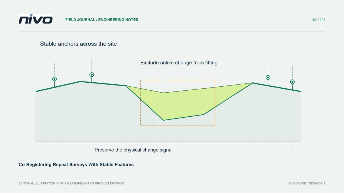
Estimate relative alignment from genuinely unchanged observations, keep independent checks, and avoid fitting away the physical changes the project needs to measure.
Separate relative alignment from real change
Repeat surveys can differ because of actual site change and because their reference realisations or reconstructions do not align perfectly. Co-registration estimates a relative alignment so those effects can be investigated more clearly. It is different from simply placing rasters on the same grid. Establish which dataset is the reference and preserve both original versions before applying any transformation to the observations.
Select stable evidence across the site
Select features or terrain believed to be unchanged between dates, supported by acquisition records and site knowledge. Avoid stockpiles, active earthworks, vegetation, moving assets, and surfaces whose apparent geometry changes with viewing conditions. Distribute stable evidence across the area and relevant elevations or orientations. A cluster on one flat corner may poorly constrain behaviour elsewhere even when it produces a small fitting residual.
Choose a defensible transformation
Choose a transformation whose degrees of freedom match the evidence and the suspected problem. A simple shift, a rigid alignment, and a more flexible adjustment make different assumptions. Excess flexibility can absorb real deformation or create local distortions outside the fitted area. Inspect parameter plausibility and geometric support rather than accepting whichever model reduces the fitting statistic most strongly.
Keep evaluation observations independent
Reserve suitable stable observations for evaluation instead of using every available feature in estimation. Check both horizontal and vertical behaviour where the project needs them. Keep these tests independent when comparing candidate transformations. Improved agreement on the fitted features is expected by construction; it becomes stronger evidence only when withheld locations also behave consistently and the required changed areas have not influenced the fit.
Inspect residual patterns after alignment
In a hypothetical quarry monitoring project, estimate alignment from reviewed stable bedrock and permanent structures outside active extraction. Examine residuals by slope, aspect, elevation, and position, then inspect profiles through both stable and changed terrain. If systematic patterns remain, investigate their cause before reporting a change map. Do not flatten the excavated region toward the previous surface merely because including it makes a global alignment look smoother.
Deliver the correction and its limits
Deliver the stable-feature mask or correspondence set, reference dataset, transformation, withheld-check results, and original-to-corrected version relationship. Explain where support is weak and how remaining alignment uncertainty affects interpretation. Acceptance should establish a justified relative comparison without erasing the intended signal. Co-registration can improve change analysis, but absolute accuracy and the significance of measured change still require appropriate external evidence and uncertainty assessment.